Overview
Open between 5am and 10pm unless otherwise posted or permitted
Toll Free: 888-EBPARKS (888-327-2757), option 3, extension 4540
Trail Attributes
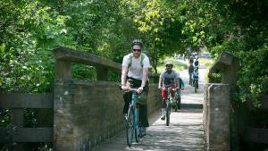
The Marsh Creek Regional Trail, in easternmost Contra Costa County, winds along Marsh Creek through bountiful tracts of farmland. The paved, multi-use trail is about 6.5 miles long and extends from Creekside Park in Brentwood to the wave-lapped Delta shores of Big Break. When completed, the trail will be 14 miles long and will connect the fertile Delta region with the wooded foothills of Morgan Territory Regional Preserve and the quiet serenity of Round Valley Regional Park east of Mt. Diablo State Park. Trail users can benefit from several community parks and greenbelts along the way, which offer respite from mid-day summer heat.
To Reach the Trail
Maps

Trail Accessibility
The Marsh Creek Trail is flat and presents no slope difficulties for persons in wheelchairs.
Trail Activities
The Marsh Creek trail is recommended for bicyclers, hikers, joggers, and runners.

Interpretive Panels
View a gallery of the Interpretive Panels located at various locations along the Marsh Creek Regional Trail.
Non-Emergency Trail Safety Hazards or Damaged Trails/Facilities: Locate a park ranger or call Public Safety Dispatch at (510) 881-1833. Be sure to mention the nature and exact location of the problem including the trail or area name.
Trail Conflicts/Violations: Call (510) 881-1833 for the Non-Emergency Public Safety Line, 24 hours a day, or submit a Park Watch Report online.
Emergency/Crime in Progress: Call 911 or (510) 881-1121 from a cell, 24 hours a day.