
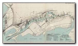
Walk to the pond observation deck
The pond you see in front of you was made to filter run-off from Webster Street and Central Avenues before draining into the Bay. Note the cement wall that helps to trap large items. The pond is now home to many animals such as mosquito fish, dragonflies, and seasonal nesting birds including mallard ducks.

Feeding wildlife is against Park District rules. Help keep them healthy, safe, and wild. EBRPD Ordinance 38
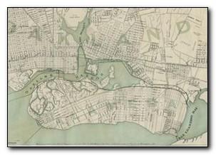
This entire area has gone through some major physical changes in the last 250 years. In 1902, Alameda was transformed from a peninsula into an island. It was the largest dredging operation before the construction of the Panama Canal!
Can you locate the line of palm trees off in the distance to the northeast? This was Alameda’s original shoreline before 1955!
Several landfill projects in the mid-1950's added the South Shore area to the island and created what we know today as Robert Crown Memorial State Beach. Since 1850, Alameda’s size has more than doubled!
Page 4 >>