
Overview
January - February: 8 a.m. - 5 p.m.
March: 8 a.m. - 6 p.m.
April: 8 a.m. - 7 p.m.
May - August: 8 a.m. - 8 p.m.
September: 8 a.m. - 7 p.m.
October: 8 a.m. - 6 p.m.
November - December: 8 a.m. - 5 p.m.
Parking: No fee
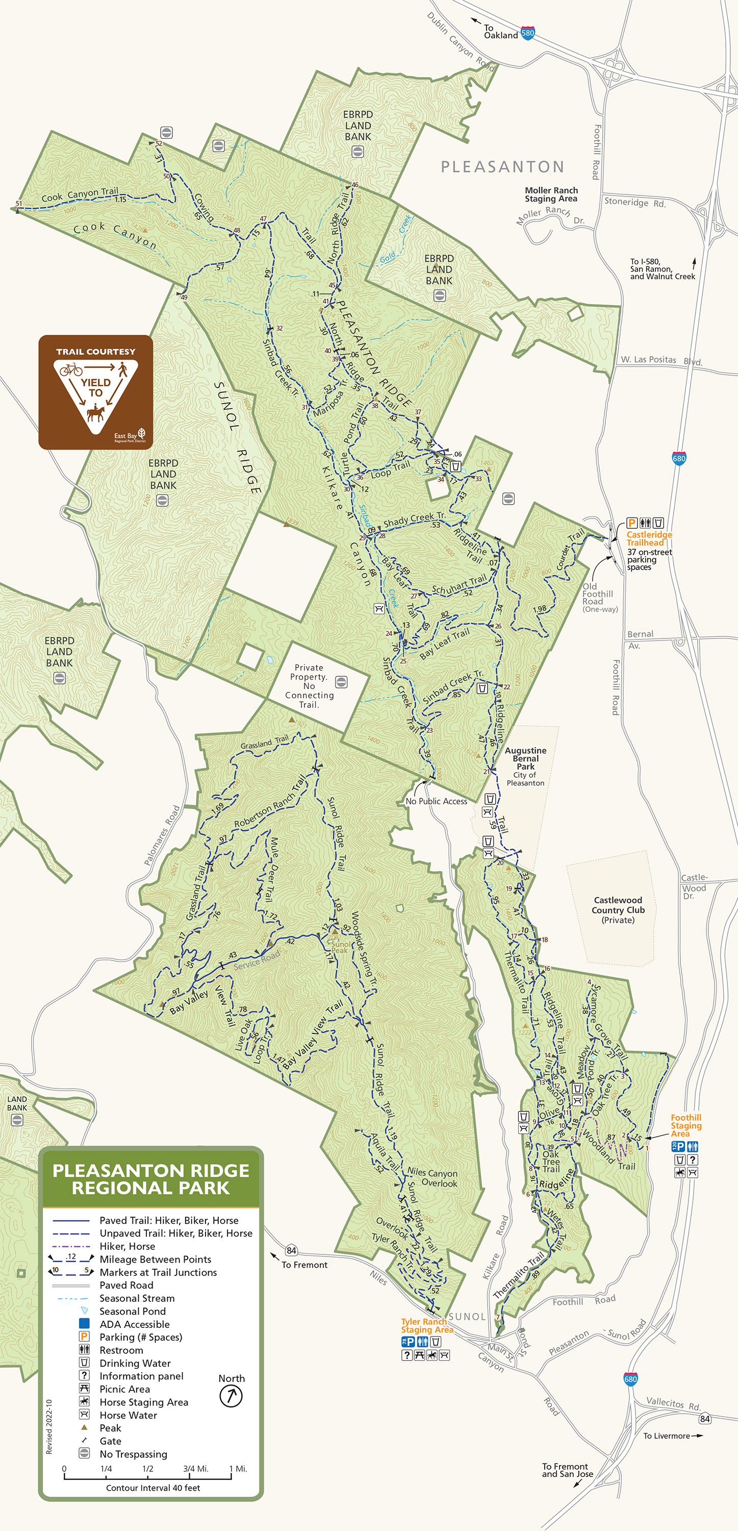
Park Entrance: Foothill Road Pleasanton, CA
Foothill Staging Area GPS: 37.614818, -121.881837
Castleridge Trailhead GPS: 37.660081, -121.911618
Tyler Ranch Staging Area: 12565 Foothill Road, Sunol, CA
Toll Free: 888-EBPARKS (888-327-2757), option 3, extension 3033
Internet & Cellular Access

Check AT&T, T-Mobile & Verizon Coverage.
Select 'Map Layers' and switch on 'No Data Coverage Areas'
Park Activities
This beautiful 9,090-acre parkland is on the oak-covered ridge overlooking Pleasanton and the Livermore Valley from the west. It is planned as the core of a Ridgelands Regional Park to be acquired over a period of many years. Parkland development has been intentionally limited to preserve the pastoral atmosphere.
The park occupies Pleasanton Ridge and beyond. To the northwest it spills down off Pleasanton Ridge into upper Kilkare Canyon, where it continues up onto Sunol Ridge, finally terminating at its westernmost corner in Stoneybrook Canyon. Inside the park, elevations exceed 1,600 feet.
From the new Tyler Ranch Staging Area, park visitors are now able to access the Tyler Ranch Trail, the Sunol Ridge Trail, and trails within the Robertson property, adding 2,844 acres and approximately 18 miles of trails to the Pleasanton Ridge Regional Park. Read more about this project on the Tyler Ranch Staging Area and Trails at Pleasanton Ridge project page.
To Reach The Park
Maps
Park Accessibility
There is one paved disabled parking and one wheelchair-accessible portable toilet in the Foothill staging area. The two old redwood-type drinking fountains would allow a wheelchair to get under but there is no smooth surface under these facilities. The park will install an upgraded fountain this summer for wheelchair users in an area by the disabled parking. There is one picnic table that can accommodate two wheelchairs and is also next to the disabled parking. The trails in the park are all multi-use dirt trails so they are more suitable for visitors who use an electric wheelchair.
Attractions
Park Activities
From the main staging area on Foothill Road, you can follow a multi-purpose trail system, which accommodates hikers, equestrians, and bicyclists. The trail system also provides canyon views, ridgetop vistas, and access to remote, deep-canyon streams.