Cyclists on Iron Horse Trail

Iron Horse Regional Trail

Hours

Open between 5am and 10pm unless otherwise posted or permitted.

Phone

Toll Free: 888-EBPARKS (888-327-2757), option 3, extension 4533

Trail Attributes

Image
ADA Accessible
ADA: trail surface, width, slope
Image
biking
Bikes: Allowed
Image
Dogs Allowed
Dogs: allowed
Image
ebikes
eBikes: Allowed
Image
horse back riding
Horses: Allowed
Image
Regional Trail
Interpark Regional Trail
Image
Kid friendly
Kid-Friendly
Image
Park trails
Park Trails

Iron Horse Trail Overcrossing Construction - San Ramon

The north side of the Iron Horse trail adjacent to Bollinger Canyon Road is closed during the construction of an overcrossing, a pedestrian/bike detour is in place. View Map. (At a later date, closure of the south side of the Iron Horse trail adjacent to Bollinger Canyon Road will also be implemented; a pedestrian/bike detour will be in place.)
The overcrossing project began on July 31, 2023, and is expected to take 18-24 months to complete. View Project information.

Trail Detour between Dougherty Rd and Dublin-Pleasanton BART Station

Until further notice, a temporary detour of the Iron Horse Regional Trail between Dougherty Road and the Dublin-Pleasanton BART Station will be in place. View Map.

The Scarlett Drive roadway project will widen and extend existing Scarlett Drive from Dougherty Road to Dublin Boulevard and provide a new segment to the Iron Horse Regional Trail. The project will require the temporary detour of the trail while roadway and utility improvements are made to Scarlett Drive. The City of Dublin will also be constructing a pedestrian and bicycle bridge connecting the Iron Horse Regional Trail on the north and south sides of Dublin Boulevard at the intersection of Scarlett Drive. The bridge will provide access to Don Biddle Community Park, which is located on the north side of Dublin Boulevard adjacent to the Iron Horse Regional Trail.  

The pedestrian bridge project will provide a safer and easier crossing for trail users and facilitate improved traffic flow along Dublin Boulevard by providing a grade-separated bridge crossing over Dublin Boulevard for pedestrians, bicyclists and BART commuters. The terminus of the southeasterly side of the bridge crossing will lead directly to the Dublin-Pleasanton BART Station. For more information on the Iron Horse Trail pedestrian overcrossing please visit the City of Dublin website located at https://dublin.ca.gov/2073/Iron-Horse-Trail-Dublin-Boulevard-Overcr.

Image
Iron Horse Trail

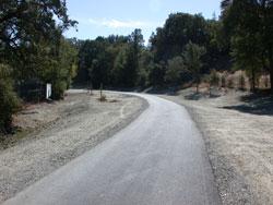
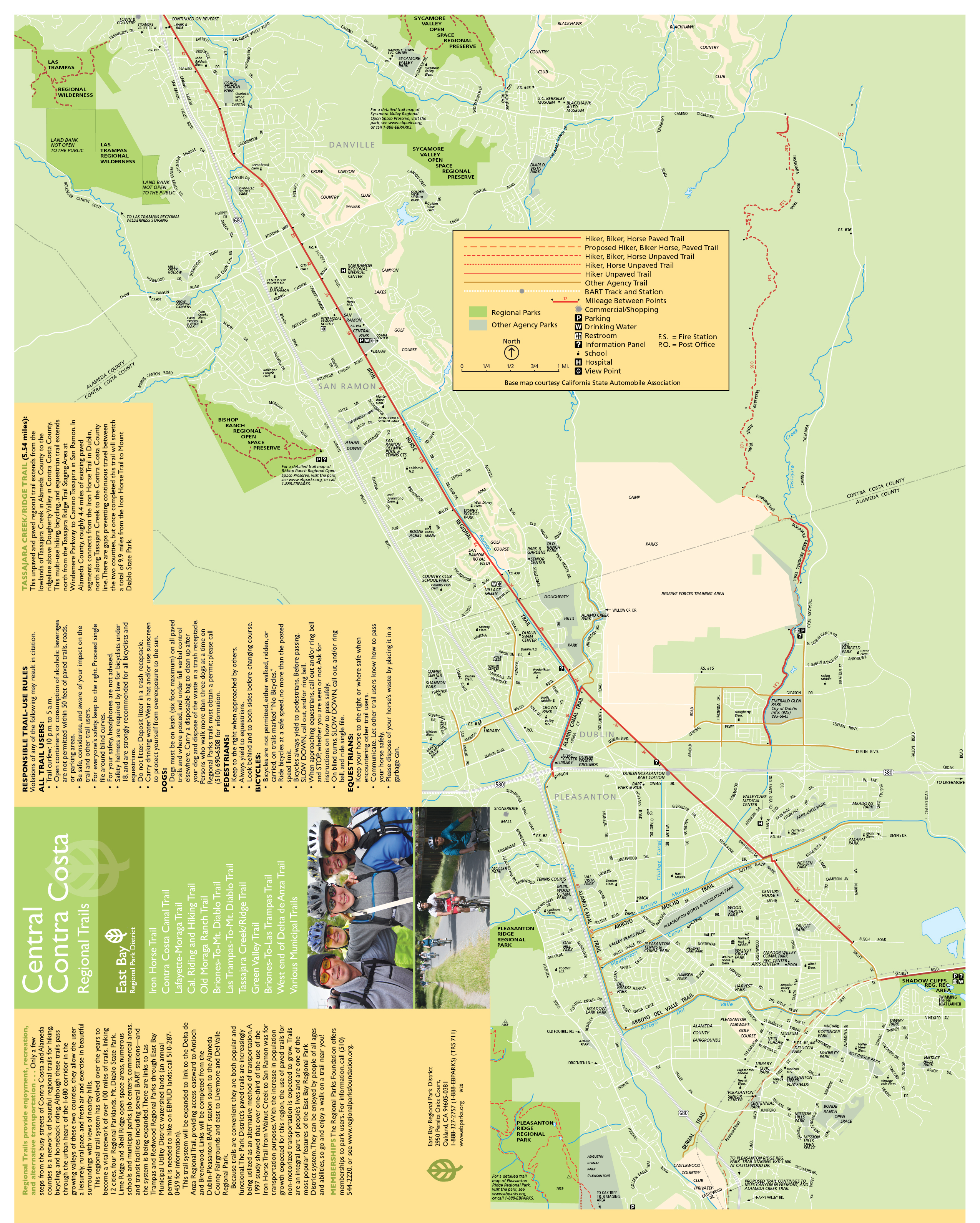
This multi-use, whole-access trail between the cities of Concord and Pleasanton follows the Southern Pacific Railroad right-of-way established in 1891 and abandoned in 1978. The completed Iron Horse Regional Trail, as of 2014, spans a distance of 32 miles. The latest segment of the Trail, which closed a gap of 1.8 miles from the Pleasanton/Dublin BART station to Santa Rita Road in Pleasanton, opened to the public on August 19th, 2014, after almost 30 years of planning and funding efforts.  Representing interagency cooperation and a community-wide effort by individuals and groups, this trail creates an important recreational and commute component for the communities it serves. The trail connects residential and commercial areas, business parks, schools, public transportation (BART, County Connection), open space and parks, regional trails, and community facilities.

The developed Iron Horse Trail begins in Concord near Highway 4. It runs south through Walnut Creek and crosses eastward under I-680 at Rudgear Road near a Park & Ride. From there the trail passes through a rural/residential area to connect with downtown Alamo and the Alamo Square shopping center. Continuing south, the trail follows a greenbelt through residential areas and into downtown Danville. It takes a jog across Danville Boulevard, passes back under I-680, and continues south past Pine Valley Road to the county line in San Ramon extending to the Dublin/Pleasanton BART and further on to Shadow Cliffs Regional Recreation Area. Eventually, the Iron Horse Regional Trail will continue extending to cover a distance of about 55 miles, connecting 12 cities from Livermore in Alameda County to Suisun Bay in Contra Costa County.

To Reach the Trail

Maps

North

Map of North Iron Horse

South

Map of South Iron Horse

Trail Accessibility

Iron Horse Trail is wheelchair accessible.

Trail Activities

The Iron Horse Trail is recommended for bicyclers, hikers, joggers, and runners.

Mileage

Trail Mileage Guide

Download: Iron Horse Regional Trail Mileage Guide

TRAIL CONFLICTS & VIOLATIONS

Non-Emergency Trail Safety Hazards or Damaged Trails/Facilities: Locate a park ranger or call Public Safety Dispatch at (510) 881-1833. Be sure to mention the nature and exact location of the problem including the trail or area name.
Trail Conflicts/Violations: Call (510) 881-1833 for the Non-Emergency Public Safety Line, 24 hours a day, or submit a Park Watch Report online.
Emergency/Crime in Progress: Call 911 or (510) 881-1121 from a cell, 24 hours a day.