Overview
Open 5 a.m. - 10 p.m. unless otherwise posted or permitted.
Parking: No fee
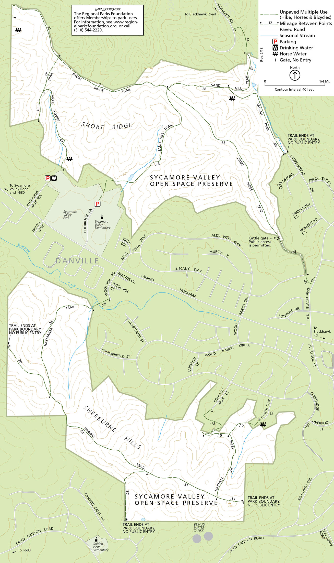
Holbrook Drive Staging Area
Holbrook Drive
Danville, CA 94506
Toll Free: 888-EBPARKS (888-327-2757), option 3, extension 4560
Internet & Cellular Access

Public WiFi is not available.
Check AT&T, T-Mobile & Verizon Coverage.
Select 'Map Layers' and switch on 'No Data Coverage Areas'
Park Activities
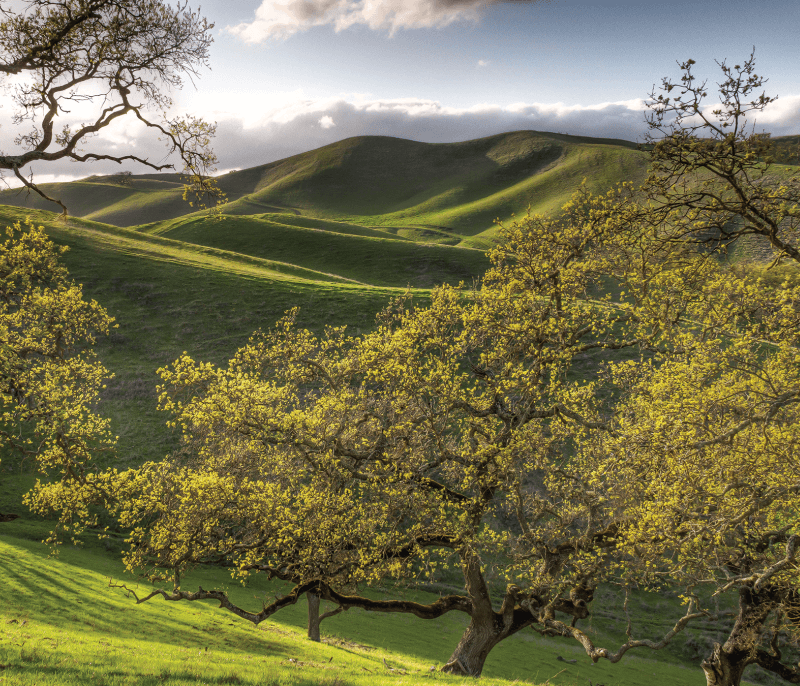
Sycamore Valley Open Space Regional Preserve occupies two major ridges located within a region of rolling hills and valleys south of Mt. Diablo. Elevations range from about 600 to 1,000 feet.
To Reach The Park
Maps
Park Accessibility
Due to steep grade, the trails are generally not suitable for wheelchair users. The Sycamore Valley Park parking lot on Sherburne Hills Road has wheelchair accessible toilets, drinking fountains and parking spaces.
Attractions
The Sherburne Hills Unit is almost entirely grassland, and the Short Ridge Unit is mostly grassland with scattered oak savanna with trees consisting of valley oak, coast live oak, and buckeye. This habitat supports gopher snakes, racers, Northern Pacific rattlesnakes, acorn woodpeckers, scrub jays, black-tailed titmouse, Western bluebirds, Northern orioles, lazuli buntings, and loggerhead shrikes (which also occur in the southern unit). The mature woodlands of the northern unit support nesting red-tailed hawks and great-horned owls, and provide cover for California quail, wild turkeys, and gray fox.
The Preserve's steep-sided gullies drain into Sycamore Creek. These intermittent drainages, along with several ponds located in the Preserve, provide limited wetland habitat for garter snakes, Pacific tree frogs, and red-legged frogs. The drainages also support raccoons, striped skunks, deer, coyotes, and bird species including ruby-crowned kinglets, chestnut-backed chickadees, vireos, warblers, red-winged blackbirds, and great blue herons. Raptors seen hunting in the Preserve include the northern harrier, Cooper's hawk, and white-tailed kite.
Upcoming Events
History
The Bay Miwok Tatcan tribe inhabited the Sycamore Valley when, in 1772, Fr. Juan Crespi with an expedition led by Captain Pedro Fages, noted the good quality of the land in the San Ramon Valley and considered it a good location for a Franciscan mission. The mission was ultimately located in present-day Fremont, and the San Ramon valley was utilized as grazing land. By 1850 the first Anglo-Americans had arrived to farm the valley. Since the main road between Mission San Jose and the State Capitol in Benicia ran through the San Ramon Valley, businesses were encouraged to establish in the area. Throughout the last half of the 1800s, Sycamore Valley farmers established the area as a productive agricultural region.
The first American settler in the vicinity of today's Preserve is recorded as Leonard Eddy in 1850. But in 1862 the Wood family began a farm and over five generations came to own and farm most of what is the Preserve today. By the end of the twentieth century Sycamore Valley land use had converted to housing. Much of the hilly ridge lands, including the Preserve, was dedicated for open space preserves. The 328-acre southern portion of the Preserve known as the Sherburne Hills unit, located south of Camino Tassajara, was acquired by the Park District in 1989. In 1998 the District acquired 255 acres north of Camino Tassajara from the Town of Danville, and an additional 106 acres from Wood Ranch developers, bringing the Preserve's northern Short Ridge Unit to 361 acres. Today, the total acreage of Sycamore Valley is approximately 696 acres.