Overview
Open between 5am and 10pm unless otherwise posted or permitted
Contra Costa Trails Office
(510) 544-3028
Toll Free: 888-EBPARKS (1-888-327-2757), option 3, extension 4517
Trail Attributes
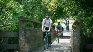
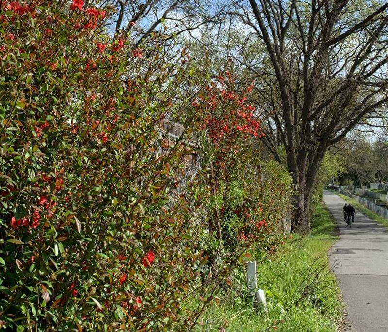
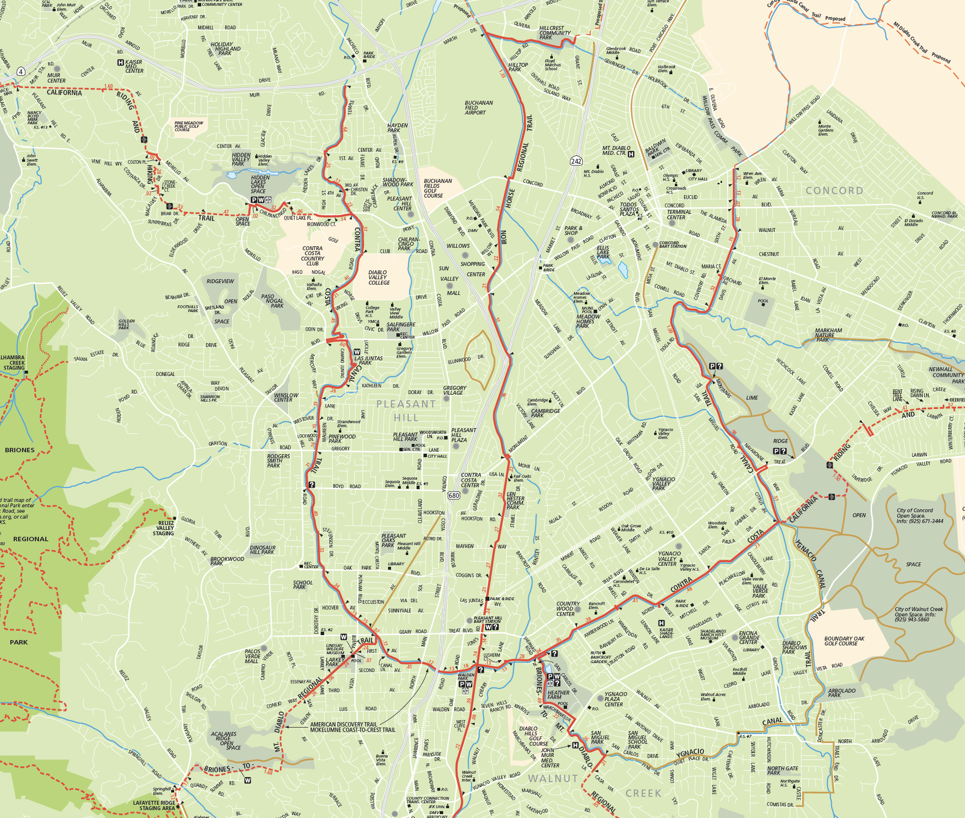
One of the most popular trails in the Park District system, this multi-use, whole-access trail (accessible to persons in wheelchairs) is a paved pathway suitable for bikers, runners and equestrians. Created through a cooperative effort by the Contra Costa Water District, the Bureau of Reclamation and the Park District, this trail provides a safe off-road corridor connecting Martinez, Pleasant Hill, Walnut Creek, and Concord.
Meandering along the Contra Costa Canal, following a horseshoe-shaped path through central Contra Costa County, the trail intercepts a number of local parks in Pleasant Hill (Las Juntas Park), Walnut Creek (Larkey Park, Heather Farm Park), and Concord (Lime Ridge). It also makes important connections to a number of regional trails, including the California State Riding and Hiking Trail, Briones-to-Mt. Diablo Trail, and the Iron Horse Trail, and will connect with the Delta De Anza Trail when it is completed to Martinez.
With access to schools, commercial areas, and public transportation (BART, County Connection), this trail is an integral factor in county non-vehicular transportation and also provides significant recreation opportunities in central Contra Costa County. From urban access to rural open space, the Canal Trail provides a pleasant recreational experience and transportation opportunity.
To Reach the Trail
Maps
Trail Accessibility
Contra Costa Canal Trail is wheelchair accessible.
Trail Activities
The Contra Costa Canal trail is recommended for equestrians, bicyclers, hikers, joggers, and runners.
History
The Bureau of Reclamation began construction of the canal in the 1930s to supply irrigation water for local crops. Delayed by World War II, construction was completed some 20 years later. The canal is maintained by the Contra Costa Water District.
Water is pumped into the canal from the Sacramento/San Joaquin Delta near Rock Slough. The water flows to Martinez, where it is treated to become the water supply for that city and several other cities. For this reason swimming and fishing in the canal are not permitted.
Non-Emergency Trail Safety Hazards or Damaged Trails/Facilities: Locate a park ranger or call Public Safety Dispatch at (510) 881-1833. Be sure to mention the nature and exact location of the problem including the trail or area name.
Trail Conflicts/Violations: Call (510) 881-1833 for the Non-Emergency Public Safety Line, 24 hours a day, or submit a Park Watch Report online.
Emergency/Crime in Progress: Call 911 or (510) 881-1121 from a cell, 24 hours a day.